![]()
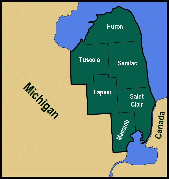
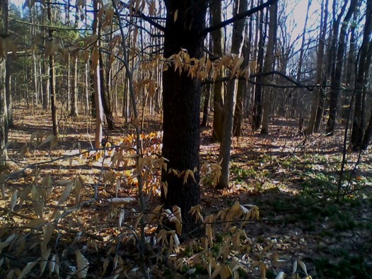
The Thumb Land Conservancy owns three preserves in St. Clair County:
- Dead End Woods Sanctuary - 17.6 acres in Fort Gratiot Township
- Gerrits Sanctuary - 38.5 acres in Ira Township
- Peltier Beach Ridge Sanctuary - 11.5 Acres in Fort Gratiot Township
![]()

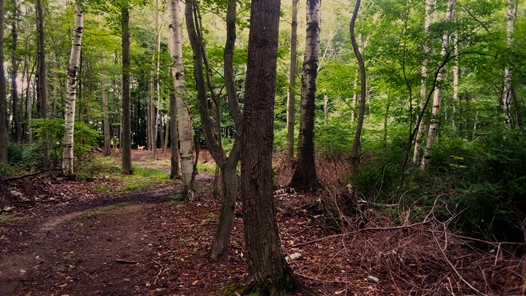
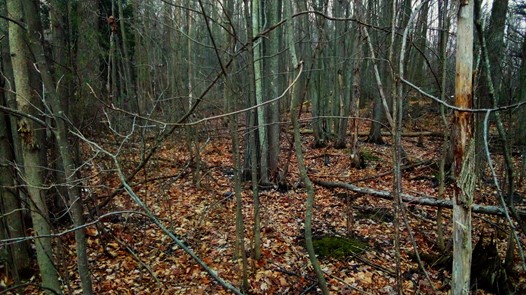
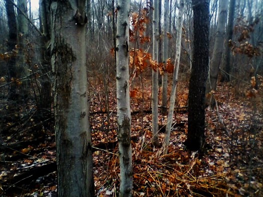
The Dead End Woods Sanctuary was the first preserve acquired by the TLC, in December 2008. The woods is known locally as the “dead end woods” because it is located and accessed at the end of Wilson Drive in Fort Gratiot Township. The preserve is located between Wilson Drive and Blueberry Lane to the south, State Road to the east, and Old Farm subdivision to the north.
More about Dead End Woods Sanctuary >>>
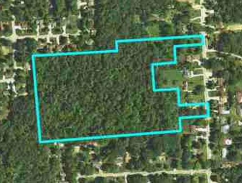

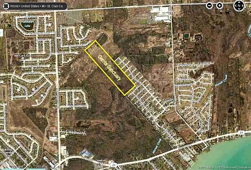
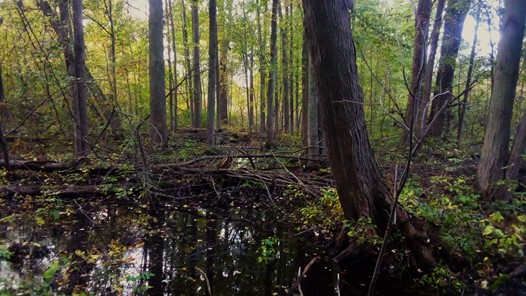
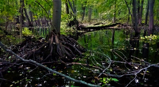
The Gerrits Sanctuary is 38.5 acres located along the east boundary of the City of New Baltimore, only about ¾ mile north of Anchor Bay and Lake Saint Clair. The southern half of the sanctuary is a complex of mature mesic and swamp forest. The north half is old-field and the Crapaud Creek Drain runs through the north end of the preserve. Years ago, the property was part of the Gerrits family farm.
More about Gerrits Sanctuary >>>

On June 28, 2010, the TLC received its third nature preserve, the 11.5-acre Peltier Beach Ridge Sanctuary in Fort Gratiot Township, Saint Clair County. The Peltier Beach Ridge Sanctuary is located a few hundred feet south of the end of West Montevista Drive, south of Metcalf Road, and along the east side of the Detroit Water Board property. The intake pipes from Lake Huron for the Detroit Water facility are very near the north property line. Also just north is the Galbraith Plant Preserve owned by the Michigan Nature Association, and four small lots north of the MNA preserve, owned by the Saint Clair County Drain Commissioner to be preserved as wetland mitigation for a future project. Although some people use the Detroit Water line property to enter the sanctuary from East Montevista Drive, the actual entrance is from North Shoreview Drive, just east of the intersection with San Juan Drive.
More about Peltier Beach Ridge Sanctuary >>>

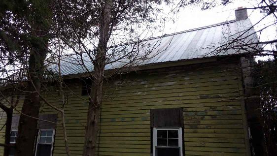
The TLC purchased the old North Street general store, post office, and rail station through the Saint Clair County tax auction. This historic structure would have otherwise been demolished. The North Street station is one of only two remaining stations between Port Huron and Croswell along the old Port Huron and Northwestern Railway which opened in 1879. The main line ran from Port Huron to Saginaw, with branches to Sandusky, Port Hope, and Port Austin. The line became part of the Pere Marquette Railroad in 1889. The main structure on the North Street site probably dates back to at least 1889, but was later partially modified in the mid 1940’s to serve as a residence.
The TLC is partnering with the Clyde Historical Society to protect the structure and fundraise for restoration. We are currently restoring the exterior and plan to install signs describing the history of the site. Eventually, we would like to restore the interior, display related historical artifacts, and open it for meetings and public events.

TThe Michigan Nature Association donated this small preserve to the TLC, formerly known as the Galbraith Plant Preserve, which is located only about 150 feet north of our Peltier Sanctuary. It is a tiny part of the same dune and swale forest that extends across the Peltier Sanctuary and for several miles north and south along Lake Huron. Michigan Nature Association founder, Bertha Daubendiek, established this preserve back in 1972 as a place to transplant native wildflowers from the adjacent Detroit Water Board property before the Lake Huron water intake facility was constructed. The TLC renamed the preserve in honor of Bertha Daubendiek, to “Bertha’s Haven”, borrowing part of an older name for the preserve.

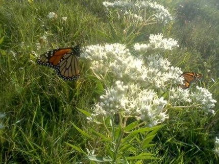
TLC attorney Timothy Lozen, arranged donation of the Loznak Sanctuary, along with a small endowment fund, from Loznak Real Estate Enterprises, LLC. The Loznak Sanctuary honors the memory of Charles and Elizabeth Loznak. The sanctuary is located adjacent to an industrial area along Wills Street in Marysville, east of Busha Highway in Marysville. Despite the impact of previous industrial use connected with a World War II munitions factory, the Loznak Sanctuary is covered by an impressive remnant of lakeplain prairie and patches of recovering young forest interspersed with the remains of concrete foundations reminiscent of monuments. Lakeplain prairie species on the Sanctuary include Riddell’s Goldenrod, Fringed Gentian, Rough Blazing-star, Mountain-mint, Showy Goldenrod, Foxglove Beard-tongue, Nodding Ladies’-tresses, Yellow Lady-slipper orchid, Switch Grass, Three-awned Grass, and Oatgrass. A unique plant species on the Loznak Sanctuary is Tall Boneset, a relatively recent arrival from the east coast via railroads, but uncommon and not recorded any closer than Monroe County. It is apparently not native to the region, but it is not invasive and it attracts a lot of Monarch butterflies.
The Loznak Sanctuary is adjacent to the old Port Huron and Detroit Railroad line with an old rail spur running through the middle of the sanctuary. It is also adjacent to approximately 26 acres of unusual ridge and swale forest with an interesting alluvial origin along the Saint Clair River dating back almost 5,000 years ago. Historic aerial photographs and mapping show that, other than limited use of the property as part of a munitions factory, beginning and ending with World War II, the land appears to have been generally undisturbed. A 1937 aerial photograph shows the Loznak Sanctuary and vicinity was completely vacant and part of a large swath of mostly open land along the Saint Clair River which may have been farmed briefly, but more likely grazed. Similar lakeplain prairie habitat in the Marysville area, where land use was not so intensive, serves as a refuge for plants remnant of original populations that existed prior to Euro-American settlement. Michigan Threatened Sullivant’s Milkweed – Asclepias sullivantii, a rare lakeplain prairie plant found in only 8 southeast counties in Michigan, is known from several nearby locations in the Marysville area.

The Bidwell Sanctuary is one of the best examples of dune and swale forest remaining along the eastern shoreline of the Thumb. Acquisition of the Bidwell Sanctuary was a major preservation accomplishment for the TLC on behalf of the Blue Water Area. Major project funders included The Carls Foundation of Bloomfield Hills, the Community Foundation for Southeast Michigan, the Consumers Energy Foundation, Cargill, Inc. and Cargill Salt of Saint Clair, the Community Foundation of St. Clair County, the Franklin H. and Nancy S. Moore Donor Advised Fund of the Community Foundation of St. Clair County, and SEMCO Energy Gas Company of Port Huron.
The Bidwell Sanctuary is an important part of the proposed Southern Lake Huron Coastal Park, a band of several preserves and parks extending along Lake Huron through Fort Gratiot and Burtchville Townships. The preserves are generally inaccessible to the public and somewhat disconnected from each other, but not by much. The TLC is within reach of creating a continuous 4.5-mile coastal park and trail connecting the Port Huron area to the day-use area of Lakeport State Park. The Southern Lake Huron Coastal Park would encompass most of the remaining dune and swale forest from Lake Erie to the tip of the Thumb. Once connected, the Southern Lake Huron Coastal Park is likely to become a regional destination for bicyclists, birders, naturalists, and other visitors.
The dune and swale forest complex is a very unique formation of parallel sand ridges and muck wetlands that formed about 4,500 years ago as the high water of the early Great Lakes quickly receded. After being depressed for thousands of years by glacial ice about 2 miles thick, the land in our region began rising as the last glacier melted back. The land is still rising slightly. As the land rose, the old Georgian Bay outlet of the early Great Lakes was blocked. The Nipissing stage of early Lake Huron rose about 15 feet above the present elevation. Great Lakes water was still draining through the old Chicago outlet, but then redirected to the Saint Clair River outlet which quickly down-cut. The high water rapidly drained, leaving a series of parallel sand ridges separated by mucky wetland troughs or swales from about 2 miles inland to the present shoreline. The ridges were wind-blown dunes and the mucky swales were shrub swamp for a long time before becoming forested and covered largely by cedars.
The dune and swale forest complex provides critical shoreline habitat for uncommon and rare plant and animal species found in few other parts of Michigan, such as Purple-flowering Raspberry, almost identical to Thimbleberry of the Upper Peninsula, Yellow Lady-slipper orchid, Pink Lady-slipper orchid, Eastern Hognose Snake, and Blue-spotted Salamander, as well as a great abundance of migratory birds that move and nest along Lake Huron.

The TLC purchased the 0.45-acre Tranquil Ridge Sanctuary located along Lake George Road near the Oakland County border in Dryden Township, Lapeer County. The Sanctuary is located on top of a narrow ridge along the east edge of a huge forested valley, nearly 1 mile across and 2 miles long, with a series of lakes and wetlands at the bottom. This impressive ice-contact landscape formed as retreating glaciers left massive ice fragments across the interlobate region. These large ice blocks, surrounded by outwash deposits. melted away, leaving steep embankments around a depressions full of meltwater known as a kettle lakes.
Tranquil Ridge Sanctuary is covered by a dry-mesic forest community of Black Oak, White Oak, Black Cherry, Big-tooth Aspen, and Sugar Maple. The Sanctuary is located in a relatively untouched natural area, but there was an old cottage on the adjacent property years ago, part of an Ford Motor employee retreat that was later used as a music camp. Limited soil disturbance allowed invasive plants like Black Locust, honeysuckle, and privet to spread onto what would become the Sanctuary.
Although the Tranquil Ridge Sanctuary is a very small property, it is part of a much larger natural area, largely covered by mature oak forest. Not only is it an interesting and uncommon glacial landscape in Michigan, but it is very scenic and largely undeveloped and forested due to the extreme slopes. Future development of the area is most likely to be limited to very disperse single-family residences. For now, you can sit on one of the boulders on top of the ridge and look out over the valley with Brooks Lake shining below and feel the solitude.

The TLC purchased the Full Circle Sanctuary in the 2022 State land auction. The Sanctuary was formerly part of the Port Huron State Game Area and is covered by an extensive swamp forest interspersed with low upland sand ridges covered by oaks. It is also located in an area of well-document Painted Trillium occurrence, a Michigan Endangered wildflower that is now recorded only from Saint Clair County in all of Michigan.
The TLC named the Sanctuary in honor of the Full Circle EcoHouse of Prayer in Port Huron and the continuing work of Sisters Veronica Blake and Concepción González, well-known members of the Blue Water area environmental community. Sister Veronica and Sister Concepción are members of the United States Region of the Sisters of Mary Reparatrix, an international religious congregation. Since its founding in France in 1857, the Sisters of Mary Reparatrix have been dedicated to repairing fractured relationships among humans and with God. In the second half of the 20th century, global environmental crises caused them to also focus on the need for humans to repair their relationship to the Earth.

The TLC purchased the Charles Dodge Sanctuary in the 2022 State land auction. The Sanctuary
was formerly part of the Port Huron State Game Area and is covered by an extensive swamp forest
interspersed with low upland sand ridges covered by a northern forest community of Red Maple,
Paper Birch, and Eastern White Pine. The Sanctuary is located in an area of well-document
Painted Trillium occurrence, a Michigan Endangered wildflower that is now recorded only from
Saint Clair County in all of Michigan. Although this preserve is just a very small piece of the Black
River valley, the TLC thought it appropriate to honor Port Huron botanist Charles K. Dodge, who
over a century ago, advocated for protection of the valley as a nature reserve. Maybe this small
preserve will lead to a bigger preserve but every piece of nature is now important.
Charles Keene Dodge served as City Attorney of Port Huron, and later, as a Circuit Court
Commissioner and City Controller. In 1893, Dodge was appointed Deputy Collector of the United
States Customs Office in Port Huron, and largely retired from legal practice, which afforded him
much more time to pursue his true interest of botany. He eventually collected about 40,000 plant
specimens, now held by the University of Michigan Herbarium. Among many works in his lifetime,
in 1900, Dodge published Flora of St. Clair County, Michigan and the Western Part of Lambton
County, Ontario. In 1911, Dodge wrote the Flora of the County section of History of St. Clair
County by William Jenks, and took this opportunity to lament the loss of native habitat in the area
even then. In the same publication, Dodge proposed the creation of a large "... public reservation
of 3,000 or 4,000 acres in one piece for St. Clair county" to preserve native flora and fauna of the
region. He wrote, "The very best place for such a proposed reservation in this county is in the
township of Clyde where Mill creek joins Black river". This is the present location of the Port Huron
State Game Area.

Through the assistance of Bill Vandercook, a Lapeer-based land conservation consultant who has worked with landowners in the region for many years, the TLC was given a generous donation of about 10 acres of property from Dr. Paul Croissant of Clarkston. Dr. Croissant was a neurological surgeon with Trinity Health in Pontiac and practiced in Oakland County since 1970. Dr. Croissant has long enjoyed the outdoors, particularly hunting, and has made several trips out West and to Africa. The Croissant Sanctuary is located just south of Ortonville along the east side of M-15 in Brandon Township, Oakland County. The property is outside of our six-county territory but not far from Lapeer County. With the donation, our intent was to sell the commercial frontage to raise funds for other land purchases, and to preserve the remaining land with a conservation easement.
In October of 2023, the TLC sold about 2.7 acres of the M-15 commercial frontage to RBF Construction, a small commercial development company based in Flint. The income from this sale allowed us to purchase the 27-acre Shorewood Forrest Sanctuary a few months later. The 2.7 acres of M-15 frontage is covered by highly degraded woodland dominated by invasive Black Locust trees and Box-elder. The traffic on M-15 further diminishes the potential habitat quality. We were fortunate to have been acquainted with RBF Construction from wetland protection work in the area. If there is any question as to their connection with nature, consider that RBF stands for “Rather Be Fishing”.
The eastern two-thirds of the property, just over 7 acres, is preserved as the Croissant Sanctuary. It contains some natural wetland, but most of the area was excavated out decades ago for sand and is now covered largely by weedy vegetation including Eastern Cottonwood, Box-elder, and invasive Reed - Phragmites. Although it is a low quality plant community, it is a natural area none-the-less, and is somewhat buffered from M-15 traffic by distance and its location down in a small valley. Being surrounded by many residents along the north and east sides, the Croissant Sanctuary should eventually serve as a nice little preserve for the neighborhood.

With generous grant funding from The Carls Foundation and income from the sale of the M-15 commercial frontage of the Croissant property donation south of Ortonville, the TLC was able to purchase another important addition to the Southern Lake Huron Coastal Park; a 27-acre parcel on the west side of Shorewood Forrest subdivision in Fort Gratiot. The Shorewood Forrest Sanctuary is part of the broad swath of the coastal dune and swale forest along Lake Huron that the TLC has been working to protect since our formation in 2008. This unique complex of parallel sand ridges and mucky wetland swales once extended from the mouth of the Saint Clair River in Port Huron, north well into Sanilac County, and inland from Lake Huron at least 2 miles in some areas.
The Shorewood Forrest Sanctuary was important to acquire in part because it allows the only likely trail connection between the two adjacent 80-acre Shorewood Forrest parcels. With this acquisition, the TLC has begun planning a 1-mile section of an unpaved wilderness-like coastal trail from near the Fort Gratiot Nature Park south of Carrigan Road, north through one of the largest forest tracts in the area. This alone will be a significant public asset. Once connected with the larger Southern Lake Huron Coastal Park, the trail and natural area should be an attraction of regional significance for hikers, birders, and others seeking a memorable outdoor recreation experience.

With generous grant funding from the Consumers Energy Foundation, the TLC was able to purchase another important addition to the Southern Lake Huron Coastal Park; the 80-acre southeast parcel along Carrigan Road, south of Shorewood Forrest subdivision in Fort Gratiot. The Shorewood Forrest Sanctuary is part of the broad swath of the coastal dune and swale forest along Lake Huron that the TLC has been working to protect since our formation in 2008. This unique complex of parallel sand ridges and mucky wetland swales once extended from the mouth of the Saint Clair River in Port Huron, north well into Sanilac County, and inland from Lake Huron at least 2 miles in some areas.
In 2014, the Saint Clair County Drain Commissioner purchased the two 80-acre Shorewood Forrest parcels west of the Shorewood Forrest subdivision as future wetland mitigation for County drain projects. The Michigan Department of Environmental Quality, now the Michigan Department of Environment, Great Lakes, and Energy (MDEGLE), allows for preservation of existing high quality wetlands as mitigation, or replacement, for State-regulated wetlands eliminated by State-permitted projects. While the north 52 acres of the parcel is protected by two State conservation easements established as mitigation for two County projects, the south 28 acres of the parcel, along Carrigan Road, remained unprotected for 10 years. MDEGLE has since required that permit applicants purchase wetland mitigation credits from mitigation banks when possible, which greatly limited opportunities for preservation of existing wetland. With little prospect of using the additional unprotected wetland on the Shorewood Forrest parcels as mitigation, the Saint Clair County Drain Office determined that they would need to sell the property.
The Shorewood Forrest Southeast Sanctuary was important to acquire because it provides a half-mile trail connection for the Southern Lake Huron Coastal Park, from Carrigan Road, just north of the Fort Gratiot Nature Park, north through our 27-acre Shorewood Forrest Northeast Sanctuary, to the west side of the 80-acre Shorewood Forrest parcel to the northwest. With this acquisition, the TLC has begun work on a 1-mile section of an unpaved trail on a large upland dune ridge through one of the largest forest tracts in the area. This alone will be a significant public asset. Once connected with the larger Southern Lake Huron Coastal Park, the trail and natural area should be an attraction of regional significance for hikers, birders, and others seeking a memorable outdoor recreation experience.
TLC Conservation Easements

Bob Putze was the first residential landowner to place a conservation easement on his land with the TLC. His property adjoins the Port Huron State Game Area along the west side of Abbottsford Road just south of Ruby. It is a nice northern forest community with lots of Eastern White Pine, and tall Red Pines that Bob planted in 1964. Edge species like Big-tooth Aspen and planted spruce are gradually dying off in the increasing shade, while shade-tolerant American Beech and Sugar Maple are colonizing the understory, a natural process known as forest succession which leads to a mature native forest community. The ground-level vegetation is diverse and of good native quality with the usual species of cool sandy soils in the Port Huron area including at least three species of clubmoss, a distant cousin of ferns, along with Canada Mayflower, Wintergreen, and Low Sweet Blueberry. A small area of wetland is covered by Royal Fern with Michigan Holly shrubs. Bob Putze’s forest is potential habitat for Michigan Endangered Painted Trillium, a rare species that occurs in the area and is now known only from Saint Clair in all of Michigan.
The Bob Putze Preserve is characteristic of the drier and more northerly forest remaining in the region. In the Port Huron area, northern forest complex is a second-growth woodland complex of mesic to dry-mesic northern forest, dry-mesic southern forest, hardwood-conifer swamp, and southern hardwood swamp on sandy soils extending across large parts of Kimball, Clyde, and Port Huron Townships. The vegetation of this complex is a unique blend of northern and southern flora, skewed largely toward northern species. This generally northern community complex covers a broad and flat landscape of coarse to fine sands deposited across the glacial lakeplain, the dominant cover being swamp forest. Smaller upland sand ridges are typically scattered throughout the complex, deposited in glacial drainageways or as glacial lake beaches and inland dunes.
Bob Putze is a very conscientious and reverent man who loves God’s creation and cares for every animal that ventures onto his land. Bob feeds them all, including deer, turkeys, rabbits, raccoons, opossums, and stray cats. Even Pileated Woodpeckers come to his suet feeder, and Flying Squirrels live in a nest box by his driveway. Bob has always felt a spiritual connection to his land. For years, he wanted to ensure that the woods would remain natural and undeveloped. The TLC conservation easement provides the legal basis for that protection in perpetuity.
Because of the value of the TLC conservation easement, Bob Putze could claim a significant federal income tax deduction over 15 years, the property taxes will not be uncapped upon sale, and he could claim a local property tax reduction.

Darrin and Kim Koester were the second landowners to protect their land with a TLC conservation easement on 79.4 acres of their 84.6-acre parcel. The Koester conservation easement protects one of the larger forest tracts remaining in Fort Gratiot Township and significantly reduced the property taxes on this large parcel. The Koester Preserve includes a large area of relatively mature, non-fragmented southern swamp and hardwood-conifer swamp forest complex on seasonally inundated to moist sands with scattered upland knolls. Wetland vegetation includes Silver Maple, Green Ash, American Elm, Eastern Cottonwood, Bur Oak, Swamp White Oak, American Hornbeam, Spicebush, Dwarf Raspberry, Spotted Touch-me-not, False Nettle, Clearweed, Marsh-marigold, Sensitive Fern, Royal Fern, Spinulose Woodfern, Fowl Manna Grass, Lake Sedge, and Tussock Sedge. Upland vegetation includes Red Oak, Black Oak, White Oak, American Beech, Basswood, Sugar Maple, Red Maple, Tulip Tree, Sassafras, Serviceberry, Witch-hazel, Jack-in-the-pulpit, White Avens, Solomon-seal, Wild Geranium, and Yellow trout-lily. Many of the native forest plant species are typically of a more northern distribution in Michigan, including Paper Birch, Eastern White Pine, Eastern Hemlock, Speckled Alder, Black Chokeberry, Meadowsweet, Low Sweet Blueberry, Dwarf Raspberry, Wintergreen, Goldthread, Canada Mayflower, Wild Sarsaparilla, Foamflower, Wood Anemone, Bracken Fern, Royal Fern, Northern Lady Fern, Ground-pine, and Ground-cedar. Likewise, there are species that are typically more southern, including Black Oak, Sassafras, Tulip Tree, and Spicebush. This sort of southern-meets-northern forest is characteristic of the Blue Water Area, a transitional vegetative region where nearby Lake Huron maintains cooler summers and warmer winters.
The Koesters developed their residence on the north end of the parcel which was cleared decades ago and covered by planted pines along with very common or weedy species such as Apple, Black Cherry, hawthorn, Gray Dogwood, Autumn-olive, Common Buckthorn, Tartarian Honeysuckle, Common Blackberry, Late Goldenrod, Panicled Aster, and grasses. Portions of this area have so many apple trees, it appears there may have once been a small orchard here. The TLC assisted the Koesters in avoiding regulated wetland impacts, identifying invasive shrubs such as buckthorn and honeysuckle, and advised them on invasive weed control methods.
In addition to receiving a substantial local property tax reduction, because of the value of the TLC conservation easement, the Koesters could take a significant federal income tax deduction over 15 years and the property taxes will not be uncapped upon sale.

Michael and Gail Anderson have protected 24.9 acres of their 40-acre parcel for passive recreation and low-intensity land-use such as hunting, firewood cutting, and limited forest management. Most of the conservation easement site is forested, a complex of mid-successional second-growth mesic to wet-mesic northern forest on sand ridges and southern hardwood swamp on wetland swales. The Anderson Preserve includes about 7% of the remaining forest in the section, which is part of a broadly agricultural landscape in Huron County. The mesic and wet-mesic northern upland forest includes Red Maple, Red x Silver Maple hybrids, Paper Birch, Black Cherry, Bigtooth Aspen, Basswood, Sugar Maple, Bur Oak, American Hornbeam, Ironwood, Juneberry, Choke Cherry, Dwarf Raspberry, Bracken Fern, and Wild Geranium. The southern hardwood swamp wetland forest includes Silver Maple, Red Maple, Red x Silver Maple hybrids, Green Ash, Eastern Cottonwood, Bur Oak, Swamp White Oak, Silky Dogwood, Dwarf Raspberry, False Nettle, Clearweed, Sensitive Fern, Spinulose Woodfern, and Tussock Sedge. Scattered shrub thickets under canopy openings and along the forest edges are dominated by Silky Dogwood, Gray Dogwood, Riverbank Grape, Sensitive Fern, Late Goldenrod, and Tussock Sedge. Minor inclusions of shrub swamp, wet meadow, and upland old-field are scattered throughout the forest and along the edges. Approximately 4.6 acres of the Anderson Preserve is part of a roughly 7.5-acre lake excavated in a sand ridge. Roughly half of the Anderson Preserve consists of State-regulated wetland which is connected to a creek that flows into Lake Huron north of the village of Port Hope.
Because of the value of the TLC conservation easement, the Andersons are able to take a significant federal income tax deduction over 15 years, the property taxes will not be uncapped upon sale, and they may be able to claim a local property tax reduction.

Andy and Natalie Ellis, in partnership with adjacent landowners Michael and Gail Anderson, have protected 34.4 acres of their 42.5-acre parcel for passive recreation and low-intensity land-use such as hunting, firewood cutting, and limited forest management. Most of the conservation easement site is forested, a complex of mid-successional second-growth mesic to wet-mesic northern forest on sand ridges and southern hardwood swamp on wetland swales. The Ellis Preserve includes about 7% of the remaining forest in the section, which is part of a broadly agricultural landscape in Huron County. The mesic and wet-mesic northern upland forest includes Red Maple, Red x Silver Maple hybrids, Paper Birch, Black Cherry, Bigtooth Aspen, Basswood, Sugar Maple, Bur Oak, American Hornbeam, Ironwood, Juneberry, Choke Cherry, Dwarf Raspberry, Bracken Fern, and Wild Geranium. The southern hardwood swamp wetland forest includes Silver Maple, Red Maple, Red x Silver Maple hybrids, Green Ash, Eastern Cottonwood, Bur Oak, Swamp White Oak, Silky Dogwood, Dwarf Raspberry, False Nettle, Clearweed, Sensitive Fern, Spinulose Woodfern, and Tussock Sedge. Scattered shrub thickets under canopy openings and along the forest edges are dominated by Silky Dogwood, Gray Dogwood, Riverbank Grape, Sensitive Fern, Late Goldenrod, and Tussock Sedge. Minor inclusions of shrub swamp, wet meadow, and upland old-field are scattered throughout the forest and along the edges. Old-field covers the west end of the Ellis Preserve, dominated largely by Wild Carrot, Late Goldenrod, and unidentified grasses with scattered Big Bluestem Grass. Roughly half of the Ellis Preserve consists of State-regulated wetland which is connected to a creek that flows into Lake Huron north of the village of Port Hope.
Because of the value of the TLC conservation easement, the Ellises are able to take a significant federal income tax deduction over 15 years, the property taxes will not be uncapped upon sale, and they may be able to claim a local property tax reduction.